When I signed up for the Humboldt Randos 1000k earlier this year, I started looking around for 600k brevets somewhat near the date of the 1000k to serve as training rides. I knew I would be riding the Pinnacles 600k, but that was 3 months away from the 1000k, which seemed long. I quickly found the Willamette Randos Smith River 600k was scheduled for mid June, only a month away from the 1000k. The route seemed based in Eugene, a stop on the Amtrak Coast Starlight route, and I found an interesting lodging option in the International Hostel of Eugene!
I contacted the ride organizer, not really knowing the vibe of the group but feeling pretty sure it would be nothing like my home club of San Francisco. SFR is one of the biggest, or the biggest depending on your chosen metric, clubs in RUSA. It’s not unusual to get 100 riders or more on our popular rides. If I remember correctly, the first brevet I ever did, the Point Reyes Light House 200k, had a rider limit of 175, and that limit was reached! I had a sense that the Willamette Randos did not have that kind of volume, so I emailed Michal Young, the RBA for the Willamette region, to ask some open ended questions about signing up. He was very nice and thoughtfully answered all my questions about riding the Smith River 600k, so I went ahead with my plans to do the ride. When I arrived in Eugene the afternoon before the ride, he stopped by the hostel on his way home from work to say hi.

Eugene Hostel

The Bloom Room

lovely front porch

front porch decorative item
Day 1
The ride start was at a little restaurant with a large patio and picnic tables outside. I checked in, paying the $10 ride fee in cash. There was a wide range of bike types among the riders: level tubers (level top tube) with fenders like myself and sporty carboners alike. Everyone was really nice and before long, the RBA began his pre ride talk.

Bon matin tout le monde!

Pre ride talk. Oath is implied
A 300k was being run on the same day with the same route as the 600k up to about 250k, and there were ten riders in all. Michal was not riding either one, but generously rode out with us to make sure we all made the turns correctly to get to the beautiful bike path along the river.

Tip of the spear!
I loved this traffic sign…

Bicycles merging!
The river path was very pretty, a perfect way to start a long ride.

wheeee

le peloton

The path afforded us plenty of space to chat, and I met Peter, originally from Vermont, now from Corvallis. He had just that morning received a notice from his landlord of nonrenewal of lease, he thought because of his use of his grand piano…being a concert pianist as he is. Peter had initially signed up for the 600k but changed to the 300 to go home and deal with the problem of finding a new place. Yikes! Nevertheless we found commonality in hailing from cheese and milk producing regions of the US. Anyway, before long we got to the end of the riverfront path and moved through the industrial outskirts of Eugene. The roads were wide and unoccupied an this Saturday morning, making for good chatting among us. Considering that I needed to make my return train at 5:15 pm the next day, I was not wasting any time and the group’s pace was perfect. I rode along with Julien, who when we introduced ourselves, said, “Your name will be easy for me to remember!” Ha. After riding behind me for a moment or so though, he felt the need to comment on my safety triangle. For a few years now, my partner John has been hand cutting safety triangles out of the giant orange reflective roadwork signs that blow away and become m.o.o.p. (matter out of place) on the road.

matter in place
He delights in cutting stencils into them. Logos have been a common theme, such as the Rough Stuff Fellowship logo, the Rivendell logo, the Hands on Wheels logo. He’s delved into messages too…


so much fear
…and lately he’s been enjoying displaying his scant familiarity with French slang.

isn’t it!
…the most recent being these…

oh crap
I thought they were hilarious, but unfortunately my nouveau ami Lyonnais and fraternal name-twin was not amused. “Wait a minute… do you speak French??”, he asked. “Do you know what that means? … is that like saying, ‘If you can read this, you are too close?'” Ha. But really, I thought in French, ‘merde’ spoken emphatically was an ironic version of Bon Courage. Hmmmm. Regardless, we all continued on, passing from the outskirts of Eugene into the hilly, rural forests. The road was gorgeous, twisting and weaving through farms, then thick forest, then along a river.


PNW feels

I was feeling pretty great until I got that sagging feeling in my back wheel that said nothing other than… your tire is flat… merde! I pulled off into an adjacent driveway and waved everyone on. This was the second flat of the day, in fact, after having awakened to a front flat due to a failed valve seam. Luckily I had awakened early enough to give me plenty of time to fix it before rolling out, but it meant that I was down one spare tube. Having only one spare tube on a 600k is a little unnerving, especially when you have just gotten a second flat! So I patched the faulty tube… those unending roadside patch jobs! sigh. It was only 30 km into the ride so far.
As I took care of the business at hand, I got to wave at wave after wave (only 2 waves tho) of riders I had not noticed had separated from the front group while I was having so much fun chatting. In particular I spied SFR colors! When I got underway again, I found this individual riding with Peter, and we three coasted along for a while. Linus, the SFR rider, dropped back but before he did so, I found out he was one of three of us doing the 600k, as he needed it for a PBP qualifier. Peter later told me that Linus had explained to him why he started riding long distance rides: to honor his son who was killed on his motorcycle while standing at a stop light when someone drove into him. Wow. Linus seemed to be struggling a bit so Peter decided he would sacrifice his own ride to guide Linus through the first 250k of his 600k. What a nice thing to do! Unfortunately my return train trip timing prevented me the luxury of being so generous. So I wished them both Bonne Route and went on my way.

Decorative bridge doohickeys at every river crossing

more cool bridge features
Florence was the first town with any real services after the start, at about 125k. I was definitely feeling the need for some solid food at that point but still needed to make up time after my flat fiasco, so I just stopped at a 7-eleven and moved on.

PNW 7-eleven woodpile naturally
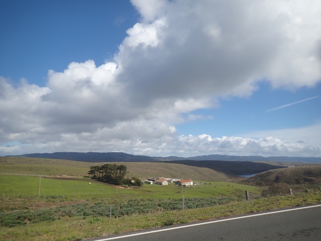
The next segment took us along the coast on the Pacific Coast Bike Route, where there were a lot of sand dunes and parks for dune buggy-ing.


sand along the hiway
There was an info control halfway between Florence and Reedsport, the next control, and I finally caught up with the main group there. They were so nice– as soon as they saw me, they held at the control until I caught up with them.

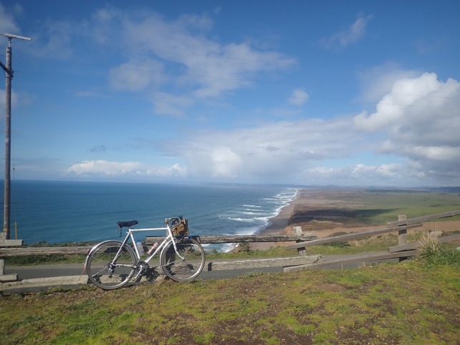
ocean views out of control
We rode along the coast highway with wide shoulders and a lot of short climbs and descents.


In Reedsport, we all took lunch together at a Safeway/Subway. Julien bought my sandwich out of sympathy for my flat tire misfortunes and to congratulate me for catching up. And I got to ask him about the use of ‘merde’ again, which had him completely perplexed about why anyone would want to place that word anywhere on one’s bike. I told him about how my French teacher in high school loved using this term to cheer on a sports team or wish someone good luck. Don’t people use it that way? he replied, “Ohhh, yes. When you want to wish someone good luck, it’s considered bad luck to wish them good luck, so you wish them–merde. But it’s never written down, it would only be something you say.” Alright then! Native French dude advises against le merde. I still left the triangle on my bike though for now… We chomped down our food and back on our bikes were we, to ride the next section along the Smith River, the brevet’s well-earned namesake. This road was truly lovely!

that ol’ good sign

Humming along


tree canopy along the river
What a treat. Our group had whittled down to five, with one person riding a gorgeous Fitz Cyclez rando machine. Most of the way was fairly flat, then a little bit of climbing after a small country store. Finally we started our major climb which was pretty steep though short. Getting toward the top felt a little like being in the Sierras… though not as much work to get there!

wildflowers and climbs


Nevertheless, I was getting pretty tired and wanted to stop for a breather, but Julien encouraged me to keep going since he knew we were almost at the top. And he was right! Just one more corner, and I saw Michal’s white van at the summit control.

woo hoo!
This control was fantastic! Michal had gotten some tasty bites lentil soup and had a jet boil, so within minutes had hot lentil soup for us! I love to eat these while camping, and I’m a huge fan of all kinds of beans and rice generally, so I knew this was going to give me plenty of energy for the 100k or so I had left in the day. And! Michal had gotten word from someone in the peloton about my being out one spare tube, so he picked up 2 extras for me! Extreme kindness award! I felt a little embarrassed at having this much attention showered on me, but it sure was appreciated.
At this point there was a steep, twisty descent followed by a few dips and berms, then the splitting off point for the 300k riders and the 600k riders. There were only 2 of us left now on the 600k, myself and Linus. So I was looking at the next 350k solo. I would definitely miss the companionship of my new found friends who had been such fun to ride with. But I had committed to this journey, so I fondly waved goodbye at the turnoff.

some more uppy-downie
After I parted with them, I still had a little more climbing, then some fun descending and a lot of flat riding to get to the overnight back in Eugene. The countryside was still gorgeous, and I was treated to a cool network of bike paths around Cottage Grove. Julien had advised me that in Cottage Grove there was a good sit-down Italian restaurant. Although I was hungry, I was more concerned about getting enough sleep at the overnight. I decided to stop at a convenience store and get some chips and soda and the ubiquitous bag of gummies. The cashier, a young guy, noticed my bike clothes (I guess?) and asked me how to be healthy. Hmm… I bashfully looked down at my purchases, solidly in the not healthy category, and nervously laughed. “Ride bikes?”, he asked? “Sure!” I brightened. He smiled. I left to go refill my bottles and inhale the unhealthy food…
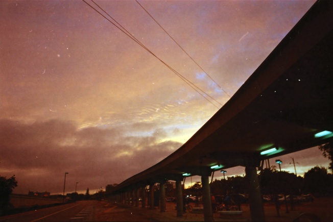
There was a younger woman outside the store, apparently waiting for someone in a parked car nearby. While she was looking down at her phone, the car suddenly pulled out of the space and sped off! She looked up and shouted after the car. She frantically screamed, “WAIT!”, but the car was gone. She started to look like she was going to burst into tears and looked down at her phone again, as if she wanted to call someone for help, but didn’t know exactly who. I was only 8 feet away from her as all this was happening. Just on total impulse, I looked her squarely in the face, getting her attention, and firmly said, “They’re not worth it.” She exhaled, said thanks, and walked off in the opposite direction from where the car went. Then I quit that crazy scene too! The rest of my ride to the overnight was flat and uneventful save for a dramatic, red flaming sunset.

nice lil park with a tool stand, picnic table, and porta pot


I got back to the Eugene hostel at about 10 pm. I had left myself plenty of food in the fridge for that night’s dinner and the following morning’s breakfast. Lots of great food options close to the hostel, grocery stores and restaurants alike. I’ve never done a ride that was set up like this, with loops out of a central start location, but it did make things easier, probably both for me as a rider and for the ride organizer.
Day 2
I left the next day at 3:30 am or so, with about 250 flat k’s to go. I wanted to try to get back to Eugene a couple hours before my train left so I could go back to the hostel for my bag and wash up a little before the 14 hour train ride. Most of my 600s have been in the 36 hour range so this would be a lot faster than my usual.
We (my bike and I) left under cover of darkness, quickly finding what I’m sure is a very scenic road in the daytime. In the night it was very quiet, with some residential areas at the beginning but then thick forest. Something I found amusing about road signs in Oregon was that they were frequently only one word, all caps. Here there were several I passed that simply said, “ROCKS”. I wish I had gotten a picture of one! Because, as I thought, “This route ROCKS”. Ha. There was another sign I often saw that just said TRUCKS. Keepin it simple!
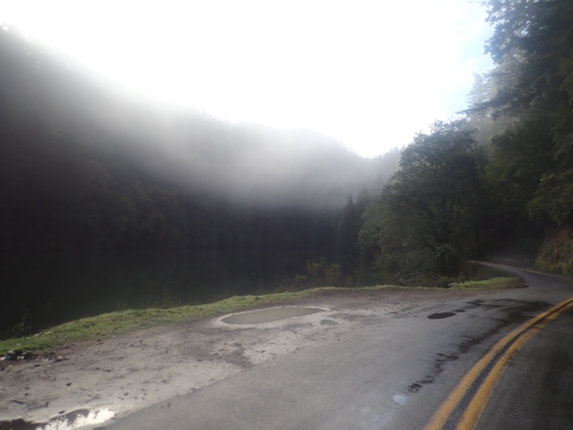
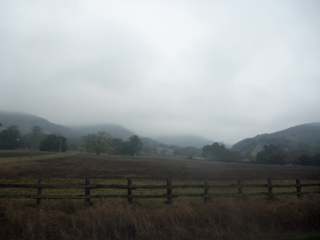
Anyway, there was a bit of a climb through this area, and when the forest opened up to some meadow lands, it started to rain! Fortunately I had checked the weather forecast before leaving Oakland, and had brought my rain jacket. I had read that there might be thunderstorms in the afternoon! I was pretty stoked about that actually. As a child in Wisconsin, summer thunderstorms were beautiful things to behold. Well, at this point in the day, the sun wasn’t up yet, it was overcast, dreary, and freezing cold! What on earth was I doing out there?!

brrrr
I learned later that this was where Linus ended up DNF’ing because he hadn’t brought a rain jacket, and he got too cold. No wonder, I was wearing every stitch I brought, and hammering to keep warm! But before long, I got to an area where there were breaks in the clouds. Lovely rays of sunlight broke through, shining on the golden fields and shapely hills.

oops mitten in the corner… hard to take photos with mittens on!

In Lebanon I decided to break for some solid food at a Starsucks there. It being father’s day, I put in a quick call to my dad, who gave me some helpful words of encouragement, and I pressed on. At this point it felt like I was really flying, and I didn’t think to notice that I had a strong tailwind. I didn’t think to notice, because there had been so much talk in the merry bunch yesterday about the luscious tailwinds I would have at the turnaround going back to Eugene. So I had a tailwind on the outbound leg which seemed odd. I decided not to think about it too much, and just enjoyed riding through farmers’ fields and the nature preserve/marsh, all wonderful, before the turnaround town of Independence.


It’s so fun to be able to make good time, and I saw another TRUCKS sign in the swamp which had sank down so that the word was barely visible above the cattails. Giggles!
I got to Independence a little early, and didn’t really see any appealing food options so just used the facilities at a park on the north end of town, ate some food in my bag, filled my water and was off again. The previously mentioned tailwind never materialized except as what you might call a reverse tailwind? Although it was a lot of work over that last 100k, it never really bothered me. As they say, “If you can’t go on, just keep on going!” So I just kept going, and as I did so, evidence mounted that I would make my train. Really that whole 100k I was pushing against the wind, but at least it wasn’t raining on me!

yes.


And the light was unreal. I love seeing bright sunlight through dark rain clouds, and it was even more interesting because of all the different crops in the fields along the way. Alfalfa is kind of this interesting blue-green color that is so fascinating to see, and rye is a gentle mauve-y pinkish color.

alfalfalfa
I listened to an album by a punchy Romany brass ensemble that I love, and was able to just eat energy bars and drink malto, and not make any more food stops. What wacky luck that I had a massive headwind here when the prevailing winds are -always- out of the north, but oh well. When you have a route with a lot of climbing, you usually get a sweet sweet descent down the other side, but sometimes a headwind can go on for hours and hours without letting up!
Reaching the Eugene city limit sure felt triumphant, since it looked like I would be able to make my train!

town of TRUCKS

almost there!
A few blocks after passing back into Eugene, I crossed over the Willamette River for the sixth and final time, and RBA Michal was sitting in a lawn chair on the other side of the bridge to congratulate me at the finish! I had texted him at various points to let him know my progress since he had said he wanted to meet me at the finish.
He had his van right there and gave me a ride back to the hostel to get my bag, and then we repaired to Cold Fire Brewing for a pint and I also got some delicious handmade taiwanese noodles from a food truck by the brew pub. The guy working the noodle truck had an Oakland Raiders hat so we got to talk about the sad Oakland sports scene for a bit.
So, I did make my train, but only to have one of the engines break down before we even got to the first stop away from Eugene, then be delayed for. eight. hours. I can only look back and laugh, honestly. Amtrak gave us all travel vouchers for our delay, and it was kind of nice to be forced to just rest my bones for an extended time. I had brought 2 gourmet cup o noodles and tons of other food with me so I was actually kinda good.
In the end, did I have good luck on this ride, or chance de merde? In the merde column: waking up in the morning with a flat tire, getting another one 30 km into the ride, freakish headwind where I should have had a tail wind, and then the whole Amtrak thing… or is that just normal Amtrak? Ha.
But then I think of all the great luck I had, like the RBA was so nice and helpful throughout my whole experience. I felt super lucky to fall in so easily with the other riders from the area too. I was lucky I brought a rain jacket! I guess some of that was making good choices. Though, I wrote Julien later to tell him I thought I would stop riding with my merde triangle, and he immediately wrote back to say, “Bonne idée!”